Tracking Change Over Time - Understanding Remote Sensing
Provided by: My NASA Data|Published on: June 29, 2021|Last updated: July 16, 2026
Grades: 6, 7, 8
Type: Lesson Plans
Subjects: Physics, Earth and Space Sciences, Geography
Authors: My NASA Data
Location: Earth

This resource has been reviewed by SubjectToClimate's climate scientists and verified for scientific accuracy and up-to-date information. Learn about our review process →
This resource has been reviewed by SubjectToClimate's climate scientists and verified for scientific accuracy and up-to-date information. Learn about our review process →
Synopsis
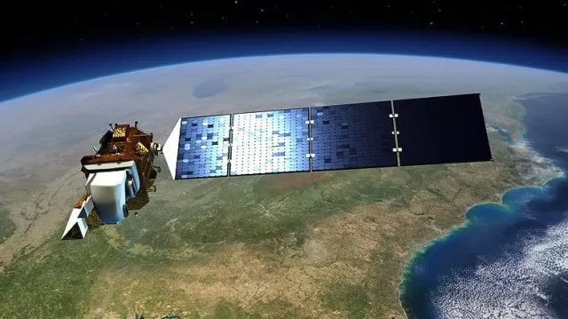
- In this lesson plan by the United States Geological Survey, students will learn the basics of remote sensing and Landsat satellites.
- Students will see how researchers use these technologies to study short-term and long-term changes to Earth's surface.
Teaching Materials
Positives
- The lesson incorporates collaborative learning strategies like think-pair-share.
- Students are able to connect Lansat use to real-life examples like foresters, firefighters, farmers, etc.
- The introductory activity includes projecting several Landsat images that will grab your students' attention.
- This lesson will further develop students' skills in mapping, technology, and higher-order thinking.
- The lesson is aligned with Next Generation Science Standards disciplinary core ideas and science and engineering practices.
Additional Prerequisites
- The Teacher's Guide features two lessons: Understanding Remote Sensing (pp. 1-12) and Using MultiSpec to Interpret Satellite Imagery (pp. 13-20). We only recommend the first lesson, Understanding Remote Sensing. The second lesson is not included in our synopsis or teaching tips.
- The lesson plan includes a teacher's guide, a student sheet, and links to images and videos.
- There is an optional physical activity that involves students measuring a 30-meter by 30-meter area. For this, teachers may need to use a bigger space like a gym or outdoor space.
- Prior to this lesson, students should be familiar with the concepts of environmental and Earth's surface changes, and should know what a satellite is.
Differentiation
- Students could be divided into groups to learn the different features of MultiSpec and pixels.
- More advanced students could experiment on their own with a sample Landsat image.
- Students could produce an annotated image that shows changes over time to the Earth's surface, or more advanced students could construct a movie using Landsat images to observe these changes.
- Other similar resources include this video on satellite forest monitoring, this article about using satellites to track ocean migrations, this lesson plan on monitoring deforestation with Landsat, and this collection of satellite images showing changes to Earth's surface.
This resource will improve students' mapping skills. Students will be equipped to identify Earth's features in a satellite image, learn about Landsat satellites, and interpret, investigate and track environmental changes such as deforestation, land cover change, and other phenomena over time. Thus, the resource is recommended for teaching.
Teaching Tips
Standards
Resource Type and Format
Scientist Reviewed
This resource has been reviewed by SubjectToClimate's climate scientists and verified for scientific accuracy and up-to-date information. Our review process ensures that every resource in our library reflects the current state of climate science.
Learn about our review process →