Forest Monitoring: Introduction to Satellite Monitoring

This resource has been reviewed by SubjectToClimate's climate scientists and verified for scientific accuracy and up-to-date information. Learn about our review process →
Provided by: World Resources Institute|Published on: April 27, 2021
VideosScientist Reviewed
6789101112
Scientist Reviewed This resource has been reviewed by SubjectToClimate's climate scientists and verified for scientific accuracy and up-to-date information. Learn about our review process →
Synopsis
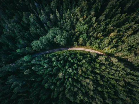
- This video explains the basics of Global Forest Watch, a nonprofit organization that uses satellites and automatic data processing to identify areas of deforestation in real-time.
Subjects: Social Studies, Earth and Space Sciences
Authors: The World Resources Institute
Region: Global
Languages: English
Teaching Materials
Positives
- Students will enjoy the beautiful animations throughout the video.
- The video highlights the contributions of the World Resources Institute in monitoring the world's forests.
- Students will learn how satellite technology can be used to remote sense the rate of deforestation globally and collect real-time data to protect forests on a global scale.
Additional Prerequisites
- Many students will be shocked at the statistic that "the world's forests are being destroyed at a rate of fifty soccer fields per minute." Feelings of sadness, anger, frustration, or shock are normal and natural.
Differentiation
- After students view the video and understand the rate of global deforestation, they can use the information to propose urgent local actions on forest protection and tree planting.
- Students could download the Forest Watcher app and work in groups to collect data on local forests.
- Other resources on this topic include this Global Forest Watch Interactive Map, this article about the role of forests in the carbon cycle, and this video about mapping the impact of forests as carbon sinks.
The video highlights the contributions of the World Resources Institute in monitoring the world's forests. Using satellite technology to remote sense the rate of deforestation globally and collect real-time data is a good innovation. This video is recommended for educators to teach students to understand the rate of deforestation globally and to take urgent local actions on forest protection and natural resource and biodiversity conservation.
Teaching Tips
Standards
Resource Type and Format
About the Partner Provider
-thumb.webp)
World Resources Institute
Established in partnership with the Bezos Earth Fund, WRI’s Electric School Bus Initiative collaborates with partners and communities to build unstoppable momentum toward an equitable transition of the U.S. school bus fleet to electric by 2030, bringing health, climate, and economic benefits to children and families across the country and normalizing electric mobility for an entire generation.
Scientist Reviewed
This resource has been reviewed by SubjectToClimate's climate scientists and verified for scientific accuracy and up-to-date information. Our review process ensures that every resource in our library reflects the current state of climate science.
Learn about our review process →


