Sponsored by the Chicago Botanic Garden Negaunee Institute, the Plants of Concern community shares the way students can visit Chicago-land natural areas to assess the plant populations and determine their overall health and survival likelihood.
The resource promotes human and plant interaction through meander-based sampling and recording of biodiversity data at local green areas.
The video included within the resource gives step-by-step directions on how to complete a protocol data sheet in order for students to be fully immersed in the process of meander-based method for sampling wildlife at the local level.
The Rapid Color Guide tool linked to the webpage serves as a scaffold for students to identify local species of plants native to the Chicago-land area.
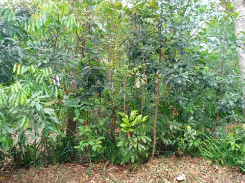
The video training guide gives a brief and condensed definition of different habitats for the assessment areas and gives examples of what plant species the student should be looking for in each of the assessment areas.
The webpage has a link with current events coming up that teachers and/or students may choose to participate in for potential volunteer service hours.
Partnerships between the Chicago Botanic Garden and other areas of the state have been created, therefore students across the state of Illinois can relate to the conservation efforts related to the threats of plant species and their habitats at a local level.
Prerequisites
Students should preview both the Rapid Color Guide and Plant Description PDFs before meandering and understand the catalogue system being utilized.
Students should be familiar with some botanical terms, types of data sampling, meander-based sampling, different types of plant species, habitat grids, and which habitats may be present in the area they are sampling.
Students should be aware that in order to get a successful sampling, they need to use both trails and go off marked paths. Therefore, proper clothing and attire should be worn in the field. Students with any allergies (i.e., environmental or insect bite) should be aware of their surroundings at all times and should have a safety plan in place in case of a possible exposure or emergency.
Differentiation & Implementation
Using the Rapid Color Guide and Plant Description PDFs included on the webpage, students can search for the plants listed in their own backyards and/or surrounding green areas.
Students can choose two or more different natural areas that have been assessed using the Rapid Floristic Quality Assessment (RFQA) to compare and contrast the data in the report PDFs.
Students can choose a park outside of the Chicago-area to explore and create their own wildlife plant guides and geographical maps to demonstrate their knowledge of meander-based data sampling and share that data with local officials.
Students can research elements of climate (i.e., temperature, rainfall, etc.) over a span of 5 years. Students can then look at the data presented in the RFQA and see if they can make a correlation between the changes in sampling data and the differences in climate. Have students write out a short report citing evidence from their research indicating how plant biodiversity and climate change are related.
Scientist Notes
Teaching Tips
Standards
Resource Type and Format
Related Teaching Resources
All resources can be used for your educational purposes with proper attribution to the content provider.