Mapping the Darien Gap

This resource has been reviewed by SubjectToClimate's climate scientists and verified for scientific accuracy and up-to-date information. Learn about our review process →
Provided by: BioInteractive|Published on: December 6, 2022
VideosScientist Reviewed
9101112AP
Scientist Reviewed This resource has been reviewed by SubjectToClimate's climate scientists and verified for scientific accuracy and up-to-date information. Learn about our review process →
Synopsis
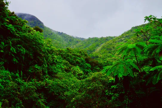
- This video and the accompanying comprehension and data analysis questions introduce students to the efforts of Indigenous people in Darién, Panama, to protect the tropical rainforest on their land from deforestation and illegal encroachment using images taken from drones.
- The worksheet includes comprehension, critical thinking, and data analysis questions, as well as maps and graphs.
Subjects: Biology, Geography
Authors: BioInteractive
Region: South and Central America
Languages: English, Spanish
Teaching Materials
Positives
- The downloadable video and worksheet are also available in Spanish.
- By the end of the lesson, students will be able to develop scientific explanations and describe how mapping can contribute to the sustainable development of protected lands.
Additional Prerequisites
- The entire activity should take about 1 hour to complete.
- It is recommended that students read the questions from the worksheet before watching the video.
- In the worksheet, students will also be asked to analyze and draw conclusions from bar graphs.
Differentiation
- Have students reflect on Indigenous peoples' vital role in conservation and climate action as land defenders.
- Have students consider why Indigenous land rights are important for Indigenous peoples and the climate.
- Engineering and technology classes can use this resource to connect to lessons about the benefits of technology and recent advancements in digital images, cameras, file storage capacity, and drones for use in conservation and other scientific fields.
- Use this article to learn more about the impact of Indigenous land tenure and this lesson to learn more about Indigenous communities' connection to the environment.
This resource provides insights on how drone technology can provide forest mapping services. It shows how the Indigenous peoples of Darién are equipped at deploying drone technology to monitor changes in their forest resources, land use, and land cover. This is an important activity to replicate in other territories and areas at risk of forest degradation and climate change. The resource is recommended for teaching.
Teaching Tips
Standards
Resource Type and Format
About the Partner Provider

BioInteractive
BioInteractive brings the power of real science stories into tens of thousands of high school and undergraduate life science classrooms.
Scientist Reviewed
This resource has been reviewed by SubjectToClimate's climate scientists and verified for scientific accuracy and up-to-date information. Our review process ensures that every resource in our library reflects the current state of climate science.
Learn about our review process →


